Map Showing Chambeshi Catchment Area
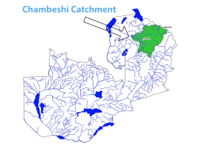
The Chambeshi River Basin is considered as the most remote headstream of the Congo River in length and therefore considered its source. The Chambeshi Catchment is approximately 44,400 m2 and geographically is located between latitudes 9o and 12o south and between longitudes 30o and 33o east. Administratively the catchment lies in eight districts and these includes; Kasama, Mporokoso, Mbala, Luwingu, Mungwi, Shiwang’andu, Nakonde, Chinsali and Mpika
It has its source in the Mbala highlands near Lake Tanganyika starting at an elevation of about 1760m above mean sea level. Afterwards, it flows south-west for about 500km before entering the Bangweulu Swamps, a vast floodplain at an elevation of about 1170m above mean sea level . The Chambeshi River is fed by a multitude of tributaries between Nakonde, Mbala and Kasama, an area which is characterized by swampy land also known as Dambos.
- Climate
According to JICA (1995), the Chambeshi Catchment experiences average October temperatures of 30.9oC and July temperatures of 9.2oC. The annual rainfall varies between 1100 to 1500mm - Water Availability
The Catchment has an estimated annual runoff of about 168mm equivalent to an average flow of 185m3/sec (JICA, 1995). Since the catchment lies in a region of high and reliable rainfall, it has a high density of perennial rivers and streams. - Land Use
The primary economic activity on the Chambeshi Catchment is agriculture and the most commonly grown crops are maize, coffee, millet, sorghum, groundnuts, beans, and rice